Survey Plan in Kenya: Secure Your Land Purchase with Confidence with this Step-by-Step Guide

Introduction
Survey Plan in Kenya: Types of Surveys in Kenya
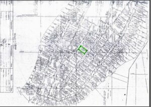
There are several types of land surveys available in Kenya, including:
- Cadastral surveys: These surveys are used to create a map of a piece of land and determine its boundaries. They are often used in the process of registering a piece of land or transferring ownership.
- Topographic surveys: These surveys involve the mapping of the physical features of a piece of land, such as hills, valleys, and waterways. They are often used in the planning of infrastructure projects, such as roads and buildings.
- Geodetic surveys: These surveys involve the precise measurement of the shape and size of the earth, as well as the location of points on its surface. They are often used in the creation of large-scale maps and in the determination of land boundaries.
- Hydrographic surveys: These surveys involve the mapping of the depths and contours of bodies of water, such as rivers, lakes, and oceans. They are often used in the planning of marine construction projects and in the determination of water boundaries.
- Engineering surveys: These surveys involve the measurement and mapping of land for the purpose of designing and constructing infrastructure projects, such as roads, bridges, and buildings.
Legal Requirements for Conducting a Survey in Kenya
In Kenya, the legal requirements for conducting a land survey are governed by the Survey Act Cap. 306 and the Survey Regulations. These regulations outline the qualifications and procedures that must be followed by surveyors in order to ensure the accuracy and reliability of survey results.
To conduct a survey in Kenya, a surveyor must be registered with the Surveyors Registration Board (SRB), which is the regulatory body responsible for overseeing the practice of surveying in the country. The SRB sets standards for the education and training of surveyors and ensures that they adhere to ethical and professional standards.
In addition to being registered with the SRB, a surveyor must also obtain a survey license from the National Land Commission (NLC). The NLC is responsible for overseeing the management and administration of land in Kenya, and it issues survey licenses to surveyors who meet its requirements.
Process of Obtaining a Survey Plan in Kenya
If you are interested in obtaining a survey plan in Kenya, there are several steps you will need to follow:
Step 1: Hire a Licensed Surveyor
The first step in obtaining a survey plan in Kenya is to hire a licensed surveyor. A licensed surveyor is a professional who is authorized by the Surveyors Board of Kenya to provide survey services. You can find a licensed surveyor by searching the Surveyors Board of Kenya website or asking for recommendations from friends, family, or your real estate agent.
When hiring a surveyor, it is important to ensure that they have the necessary experience and expertise to conduct a survey of your land. You can ask the surveyor for their qualifications and experience, as well as any references or testimonials from previous clients.

Step 2: Conduct a Preliminary Site Visit
Once you have identified a licensed surveyor, the next step in obtaining a survey plan in Kenya is to schedule a preliminary site visit. During this visit, the surveyor will examine the land and determine the scope of work required to complete the survey. The surveyor will also provide you with a cost estimate for the survey.
The preliminary site visit is an important step in the survey process as it allows the surveyor to assess the site and determine the equipment and resources required to conduct the survey. The surveyor will also be able to identify any potential challenges or obstacles that may impact the survey, such as difficult terrain or dense vegetation.
Step 3: Obtain the Necessary Documents
To obtain a survey plan in Kenya, you will need to provide the surveyor with the necessary documents. These documents include:
- A copy of the title deed or lease agreement
- A copy of the deed plan or lease plan
- Copies of any previous survey plans (if available)
The title deed or lease agreement is a legal document that proves ownership or occupancy of the land. The deed plan or lease plan is a document that provides a basic layout of the land, showing the boundaries and any existing structures. If there have been previous surveys of the land, it is important to provide copies of these survey plans to the new surveyor to ensure that the new survey is consistent with previous surveys.
Step 4: Conduct a Field Survey
Once the necessary documents have been obtained, the surveyor will conduct a field survey. This involves measuring and mapping the land, locating and marking the boundaries, and noting any existing structures or features on the land. The surveyor will also take photographs and notes to document the survey.
The field survey is the most important step in the survey process as it involves physically measuring and mapping the land. The surveyor will use a variety of equipment, including total stations, GPS receivers, and drones, to accurately measure and map the land. The surveyor will also mark the boundaries of the land using pegs or markers to ensure that the boundaries are clear and easily identifiable.
Step 5: Prepare the Survey Plan
After completing the field survey, the surveyor will prepare the survey plan. This involves creating a detailed map of the land, including the boundaries, structures, and features. The survey plan will also include a legend and a scale. The surveyor will then sign and stamp the survey plan.
The survey plan is a legal document that provides detailed information about the land, including the boundaries, structures, and features. It is important that the survey plan is accurate and complete, as it will be used in legal transactions such as the sale or transfer of the land.
The surveyor will use specialized software to create the survey plan, ensuring that it is to scale and includes all relevant information. The survey plan will also include a legend that explains the symbols and markings used on the plan, as well as a scale that indicates the relationship between the map and the real world.

Step 6: Submit the Survey Plan to Relevant Authorities
Once the survey plan is completed, it must be submitted to the relevant authorities for approval. The survey plan must be submitted to the Survey of Kenya, the Ministry of Lands and Physical Planning, and the County Government where the land is located. The surveyor can assist you in submitting the survey plan to the relevant authorities.
The approval process can take several weeks or even months, depending on the workload of the relevant authorities. During this time, the survey plan will be reviewed to ensure that it complies with the relevant laws and regulations. If there are any issues or discrepancies with the survey plan, the surveyor may need to make revisions or corrections before resubmitting the plan for approval.
Step 7: Obtain Approval and Register the Survey Plan
Once the survey plan has been submitted to the relevant authorities, it will be reviewed and approved. After approval, the survey plan must be registered at the Lands Registry. The surveyor can assist you in registering the survey plan.
Registration of the survey plan in Kenya is an important step as it ensures that the survey plan is legally recognized and can be used in any future transactions involving the land. The survey plan will be assigned a unique identification number and entered into the land registry database.
Conclusion
Overall, obtaining a survey plan in Kenya requires careful planning and attention to detail, but it is an important step in ensuring that your property is accurately documented and protected. By working with a licensed and experienced surveyor, you can ensure that the process goes smoothly and that you have the information you need to make informed decisions about your land.
